In an attempt to pin down more precisely the opening date of the railway from Serhetabat in Turkmenistan to Towraghandi in Afghanistan, I had a look at some CIA documents which are now publicly available.1
Presumably the CIA would have kept a close eye on transport links to the Soviet border.
My suspicion is that the railway was extended from Kushka into Afghanistan circa 1960-1964 as part of the Soviet-backed Kuskha – Herat – Khandahar road improvement project, which was agreed by the USSR and Afghanistan on 28 May 1959.2
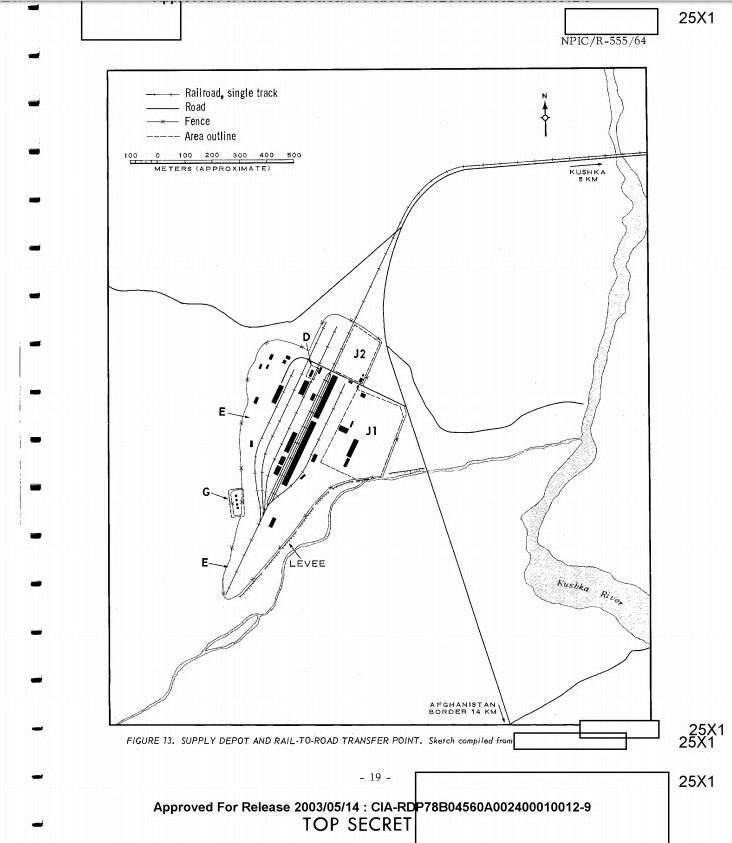
A July 1964 US photographic interpretation report describes Soviet military facilities at Kushka (now known as Serhetabat),3 with photos and a map of the “supply depot and rail-to-road transfer point” located “6 km southwest of Kushka at the terminus of the Mary-Kushka branch rail line, approximately 3 km from the Afghanistan border”.

(Map: Central Intelligence Agency, 1964)
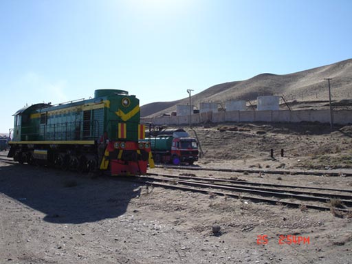
Although the site is shown in the report as being located on the Soviet side of the Afghan border, comparing the photos, map and the latitude and longitude shows that the rail facility which is being described is almost certainly the same thing as the current Towraghondi (to pick one of many spellings!) freight terminal, which is inside Afghanistan.

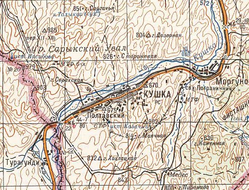
(Map: Central Intelligence Agency, 1964)
So it looks like the railway did exist by 1964, but we now have a question as to why the 1964 CIA document put the Soviet-Afghan border further south and west of the current Turkmenistan-Afghan border. As far as I know, the border in the area has not moved since being fixed in the late 19th century, and Soviet maps such as this one from 1985 show the current border with the railway extending into Afghanistan:
References
- Freedom of Information Act Electronic Reading Room, CIA ↩
- Central Intelligence Bulletin, 29 January 1969, CIA, USA ↩
- KUSHKA MILITARY AREAS KUSHKA, USSR TURKESTAN MD. Document Number (FOIA) /ESDN (CREST): CIA-RDP78B04560A002400010012-9. NATIONAL PHOTOGRAPHIC INTERPRETATION CENTER, USA ↩
